 Nadine Freischlad · · 3 min read
From city governments to plantation owners, this startup offers command center mapping
 Monitoring tasks and assets in an environment of ever-increasing complexity and speed is a big challenge for businesses and governments. But the tools available to manage that complexity are also advancing.
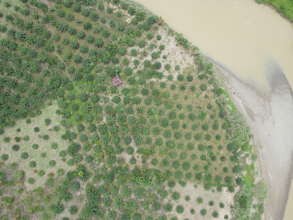
Real-time tracking of objects and people, mapping their locations and building software on top of this data is the sweet spot for Jakarta-based startup TerralogiQ. The company sets up customized dashboards from which clients can monitor the whereabouts and performance of their assets. Founded in May 2013, the company already has a notable list of corporate and government clients, including Indonesia’s national search and rescue organisation (BASERNAS) and plantation owners.
One of TerralogiQ’s better known projects is Qlue, the Jakarta government’s “Smart City” portal which lets citizens submit reports and displays them on a map.
But Qlue is only what’s visible to the public. On the government side, TerralogiQ has introduced their Q-Dashboard and Q-Workforce solutions. These tools help government officials manage the dispatching of teams to fix problems and stay updated on the status of tasks. The tools also make transparent which areas are particularly problem-ridden, or which officials are slow to respond to follow up on a task.
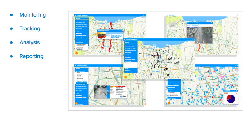
Slide showing elements of TerralogiQ’s Q-Dashboard and Q-Workforce modules as used for Jakarta Smart City
Rama Raditya, TerralogiQ’s co-founder and CEO, believes his tools can make Jakarta more livable if implemented correctly. “This dashboard can suggest, not only analyze, what actions are best to be taken by government leaders. It provides automatic advice for them, which makes faster response times.”
TerralogiQ told Tech in Asia that it has recently signed a 10-year agreement with Jakarta’s government, which is a strong signal that Jakarta’s Smart City initiative will live on even after a change of administration.
According to Raditya, Qlue might soon become a standalone company, detached from TerralogiQ. Meanwhile, TerralogiQ wants to strengthen its core products, or modules, which it adapts to the needs of individual clients.
“Our project worth ranges from US$80,000 to US$600,000 depending on the modules required. We provide modules for clients to choose from which minimizes our implementation time,” says Raditya.
TerralogiQ is an official Google enterprise partner, which means it re-sells and builds on top of existing Google solutions, such as Google Maps and Google Earth. To Raditya, Google’s geo solutions are the best visualization tools in terms of scalability, effectiveness and price.
Raditya hopes to be able to scale their concept up to serve clients across Indonesia, even worldwide. “In the next one to two years our focus is to work with clients nationwide and hopefully in a long run we will scale it up to all over Asia, then the rest of the world. We believe that command center mapping is an essential system for business owners, government leaders, even country leaders to have to monitor, track and analyze the real-time condition of their assets and people.”
So far Raditya sees no other company in Indonesia able to compete with TerralogiQ. “We would love to have competition here to keep us improving. But so far unfortunately no one has the focus and level of sophistication that we have.”



Stay updated on the go with our mobile app.
Get latest insights with smoother, more personalized experience through TIA mobile app.





📅 Upcoming Events
22 October 2026
Payoneer x CSPN Summit 2026