 Stefanie Yeo · · 7 min read
Mapmaking meets AI: How GrabMaps is mapping SEA and beyond

Every time someone orders food or hails a ride on Grab, they spend a fair amount of time looking at a map.
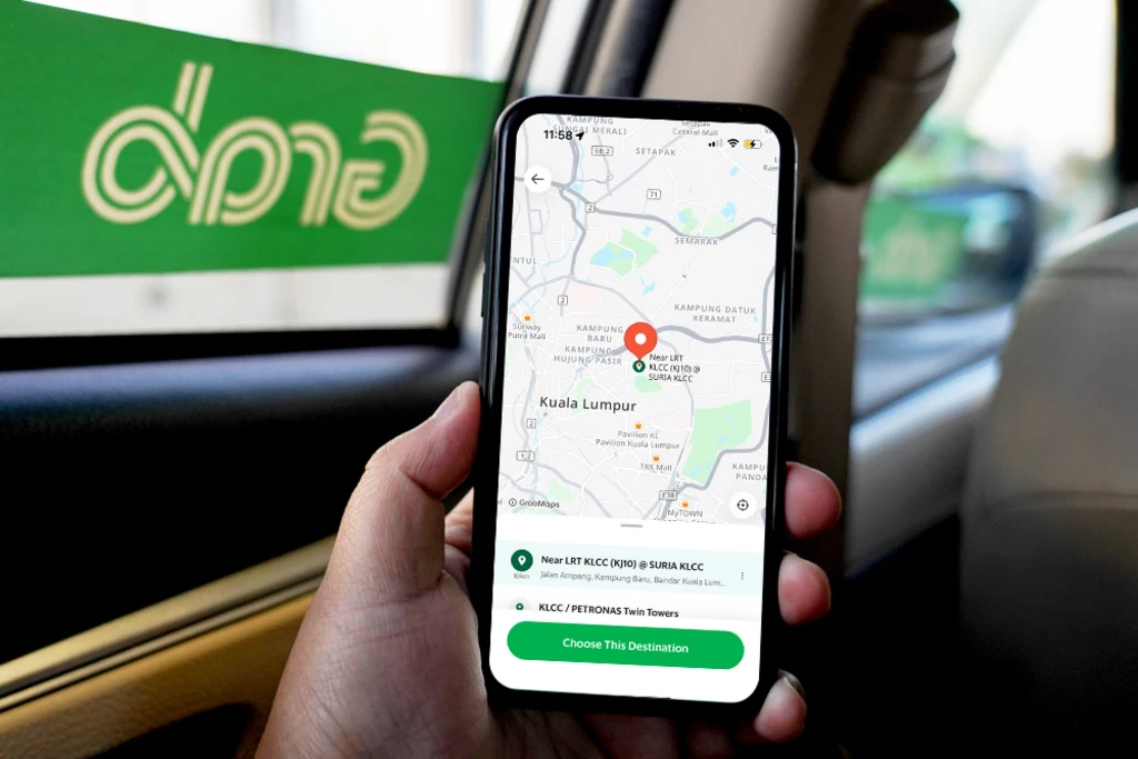
Photo credit: Grab
“Almost everything that is on our service runs on maps,” says Hannes Kruppa, head of engineering and data science at Grab. Much of the super app’s core services rely on its drivers and customers knowing where they are and where they’re going.
Grab’s mapping journey started in 2015, alongside its expansion across Southeast Asia. As it moved outside Tier 1 cities, the firm found that existing mapping solutions didn’t meet its needs and weren’t able to tackle the unique geographical nuances of the region.
“The map providers that were available in this part of the world didn’t have the product that we needed,” explains Sunny Wijewardana, head of product for geo content at Grab. “So we took on the challenge of building it ourselves.”

Hannes Kruppa, Grab’s head of engineering and data science, and Sunny Wijewardana, head of product for geo content at Grab / Photo credit: Grab
Accuracy in mapping technology is important, as it makes things more efficient. Driver-partners, for example, can complete trips faster, which means they can take on more requests, help more users, and increase their own earning potential.
Grab’s mapping service – known as GrabMaps – has evolved tremendously since the early days. The firm has been entirely self-sufficient with its mapping since 2022, powering over 800 billion API calls monthly across its vast ecosystem.
Mapping Southeast Asia
How has Grab effectively mapped Southeast Asia? According to Wijewardana and Kruppa, it’s because the company came at the challenge from both the hardware and software angles.
For instance, Grab invested in building and designing its own camera to capture the necessary street-level data for its maps. It sought to develop a solution that its fleet of driver and rider partners could use rather than the existing solutions on the market, which were built to be handled by dedicated mapmaking professionals. The company started out with the KartaCam, which could capture a 130-degree view, and recently launched the award-winning KartaCam 2, which collects 360-degree footage for a more comprehensive understanding of the landscape.
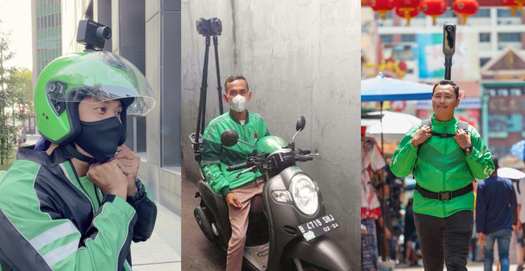
The evolution of the KartaCam / Photo: GrabMaps
All this visual data collected by the cameras is then analyzed using AI-powered technologies such as machine learning and computer vision.
“You can’t have humans go through the imagery manually – it would take years,” explains Kruppa. “You need software to inspect these images automatically and extract the necessary information to actually create a map from these images.”
To do this, Grab’s data and engineering team developed computer vision models that can extract information, such as road markings, traffic signs, street names, and signboards, to put together a two-dimensional map of each area. Over the years, the super app has fine-tuned its models to handle complex road situations and the nuances of Southeast Asia’s different countries and languages.
For example, GrabMaps’ models are trained on local scripts, such as Thai, allowing it to effectively “read” signboards and extract that information. It’s also able to identify narrow roads only accessible to motorbikes and scooters and plan routes as appropriate for different vehicle types.
The arrival of large language models – such as OpenAI’s ChatGPT – has also enhanced Grab’s ability to parse and understand all this visual data. This allows the company to create truly hyperlocal maps that meet the needs of the region, can be customized to specific use cases, and with less training for humans.
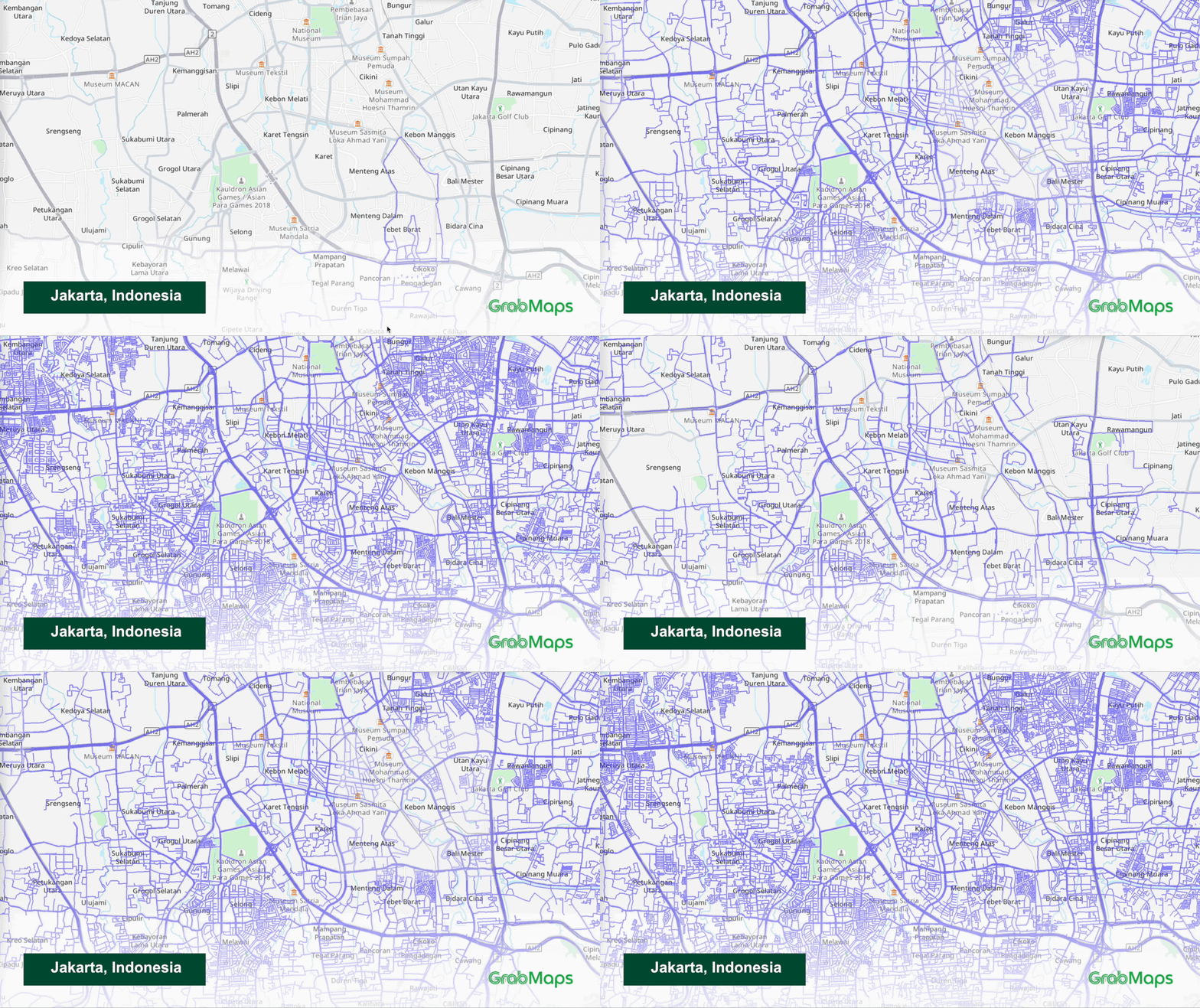
The evolution of GrabMaps’ mapping of Jakarta / Photo credit: GrabMaps
GrabMaps is also rolling out edge processing capabilities on its upcoming in-car security camera, known as the KartaDashCam. Footage can be analyzed on the camera itself, giving Grab near-real time information while also serving as a “co-pilot” to help keep drivers safe while on the road.
“Your map data becomes even fresher because you don’t have this intermediate step of loading data on the servers – you can directly send detections from the camera and updates almost immediately,” Kruppa shares.
All of this is enhanced by Grab’s extensive ecosystem, where millions of users – be it customers or its driver and rider partners – can provide feedback on road conditions, map errors, keeping its maps fresh and relevant.
“We can crowdsource a lot of information because we have the unique advantage of an app with over 41 million users and a massive fleet of drivers and riders in eight markets,” Kruppa adds.
Beyond Grab
After mapping Southeast Asia, Grab is exploring how it can bring this knowledge and expertise to build better maps for other businesses and even for other parts of the world.
To that end, the super app has made its map data and imagery available to enterprise clients, such as on-demand service providers, logistics companies, and even government organizations.
For example, it’s worked closely with Microsoft to enhance its BingMaps offering in Southeast Asia. It has also partnered with Amazon Web Services to power its Amazon Location Services solution in the region, which offers businesses access to map services APIs for their own needs.
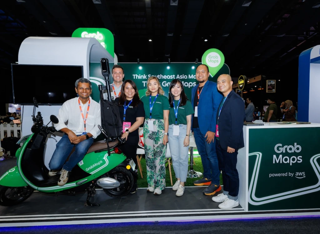
GrabMaps and AWS / Photo credit: GrabMaps
At present, it’s also working with MapMyIndia, which offers navigation and geospatial solutions. While originally based in India, MapMyIndia saw an opportunity to expand into Southeast Asia and connected with GrabMaps to gain data and insights into the region.
“Grab boasts an impressive fleet and advanced technologies capable of generating valuable data, such as traffic patterns and points of interest,” says Gino Kim, president of Asia Pacific at Mappls, MapMyIndia’s maps service.
“By collaborating and integrating [Grab’s] data with our offerings, I am confident we can encourage our existing customers to adopt our solutions for the Southeast Asian market as well.”
Aside from its mapping data, GrabMaps is also offering its end-to-end mapmaking systems to organizations outside of Southeast Asia looking to map their countries.
“Any company with access to a large fleet of drivers that wants to build their own maps as well, for whatever reason – we can help them,” says Wijewardana. “We can work with them to use the same tools we used to become self-sufficient and help them do the same.”
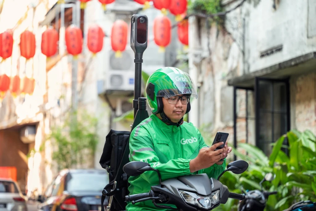
The KartaCam 2 in action / Photo credit: GrabMaps
In Wijewardana’s view, GrabMaps has only scratched the surface of what the tech can do, especially with the latest advancements in generative AI.
“We have millions of kilometers of street-level imagery, and with advancements in new technology and from our partnership with OpenAI, there’s so much information that you can extract out of it,” Wijewardana says. “We don’t even know all the use cases that somebody might have for our data – that is an emerging opportunity that we’re very excited about.”
The future of mapping
On the road ahead, GrabMaps wants to be the “source of truth” for Southeast Asia mapping.
“The goal for GrabMaps is to map anything, anywhere,” says Kruppa. Grab is working to further improve its hardware and software to ensure that it can effectively map any situation it encounters on the streets of Southeast Asia and beyond.
“Our north star is, we want to get as close to real time as possible, and then we want to index as much of the world as possible,” Wijewardana adds.
He sees exciting opportunities for GrabMaps in the digital twin space, which seeks to develop virtual replicas of physical spaces to better understand and manage them.
“Our technology has a lot of use cases that overlap with what governments want to achieve with infrastructure management, digital twins, and smart cities, so we see the opportunity to work closely with them around those use cases as something that we’re very excited about,” he explains.
Ultimately, Grab wants to create a comprehensive ecosystem to truly help people understand the world they live in.
“We’ve become an example for other ride-share companies to also become self-sufficient,” concludes Wijewardana. “And through this, we hope to move the whole world toward richer, more localized, and fresher maps.”
GrabMaps is a cutting-edge hyperlocal mapping solution developed by Grab, designed to address the unique navigation challenges of Southeast Asia’s complex urban landscapes.
Leveraging real-time data from millions of daily transactions and a vast network of driver-partners, GrabMaps provides businesses with an enterprise-grade mapping solution that enables enhanced operational efficiency and customer experiences across various industries.
Learn more about GrabMaps on its website here.
This content was produced by Tech in Asia Studios, which connects brands with Asia’s tech community. Learn more about partnering with Tech in Asia Studios.
Stay updated on the go with our mobile app.
Get latest insights with smoother, more personalized experience through TIA mobile app.
Recommended reads
 SEA financials tracker: Moladin’s revenue rises 6% in 2025
 Flipkart’s costly late push into quick commerce and food delivery
 Inside Singapore’s government team that kills its own products
 Once an IPO hopeful, SCI Ecommerce nears collapse
 Who’s betting big on ChatGPT ads? Not Asian brands
 VC tracker: Granite Asia launches US$50 million fund
 GCash trims IPO ambitions to meet market realities
 Igloo CEO eyes global M&A: ‘We have an appetite to grow more’
 Why SBI paid a premium for Ajaib amid a tough market
 OpenAI warns building for today will cause technical debt





Editing by Winston Zhang and Jaclyn Tiu
(And yes, we’re serious about ethics and transparency. More information here.)


📅 Upcoming Events
22 October 2026
Payoneer x CSPN Summit 2026