Following last Saturday’s floods in Beijing, my colleague Charlie pointed out the subsequent anger over why the city wasn’t prepared – in particular why authorities didn’t send out warning text messages over mobile. In addition to that shortcoming, it appears that the city didn’t do an especially good job in mapping flooded areas, as we can see in the map below released by the Beijing Water Authority. As you can see, it isn’t exactly the easiest thing in the world to read. Perhaps there’s a higher resolution version out there, but this seems to be the one circulating on the internet.
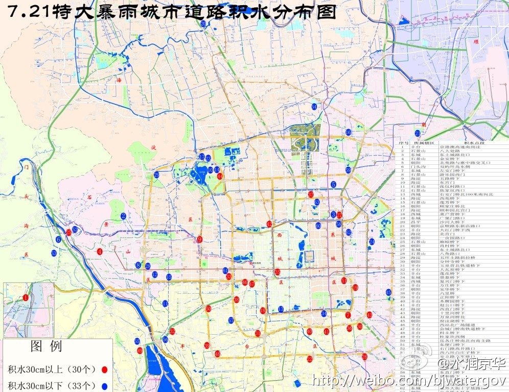
click for full size
But thankfully netizens got in on the action too, according to the China Daily:
The municipality’s map went online after several similar homemade ones. The online campaign was initiated at Guokr.com, a social network website for science fans. Registered users at the website shared their experience of the flooded roads. A netizen with the Internet name of “goldengrape” compiled the experiences and released a Google (NASDAQ:GOOG) map of the roads and communities that had been flooded (see below).
I’ve talked a lot about the importance of Google services and how they helped in the wake of Japan’s earthquake last year. Thankfully, our friend ‘goldengrape’ could crowdsource the map you see below this time. Although Chinese netizens are at a big disadvantage without full access to Google’s repertoire of services in my opinion.
Such maps not only serve as important digital archives of a tragic event, but they also serve as a guide of places to avoid should Beijing be hit with similar rains in the future.
在較大的地圖上查看北京暴雨危险路段





Stay updated on the go with our mobile app.
Get latest insights with smoother, more personalized experience through TIA mobile app.