
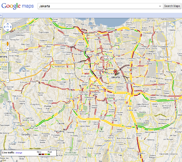
If you are driving on the streets of Jakarta and have the Google Maps service switched on, you can now find information about traffic around town. Google just rolled out this feature for the Indonesian capital, a handy tool to help drivers avoid traffic jams.
With the help of traffic information from data provider PT Neo Fusion Indonesia, Google Maps also updates with crowdsourced and anonymous data from GPS devices on the streets of Jakarta. In this way the map can indicate smooth road conditions green line, or show a traffic jam in red or black.
Dr. Elly Sinaga, a director from the Ministry of Transportation expressed her happiness about having this real-time traffic information:
The traffic feature on Google Maps is certainly very useful for people in Jakarta who now have a tool that will help them plan their travel in the city more efficiently. They can use this traffic information from their computers or cell phones to avoid unexpected delays and to reach their destination faster.”
In addition to Google Maps, social media also can help you to deal with road traffic in the capital if you follow the Jakarta Metro Police‘s Twitter account. Similarly in India, the Facebook page of the Noida Traffic Police became very popular after providing traffic information submitted from citizens.
via Detik





Stay updated on the go with our mobile app.
Get latest insights with smoother, more personalized experience through TIA mobile app.