Adinda Pryanka · · 3 min read
The AI system turns satellite images into defense insights
This article is a part of Startup Spotlight, a series that features young, up-and-coming startups.

Photo credit: Riffai
Kolatat Katousano spent hours assembling fragmented location data for offshore wind surveys. He later faced similar delays during site selection at Schneider Electric. To eliminate these bottlenecks, he launched Riffai to automate satellite imagery analysis.
😟 Problem
Satellite imagery has been collected for decades, but turning it into reliable insights takes time, expertise, and significant resources. Organizations that manage land, natural resources, infrastructure, and security struggle to monitor large areas this way.
The founder’s research found that conventional site screening can take 15 to 30 days, with site searches consuming 40 to 80 hours per project.
💡 Solution
Riffai converts raw satellite observations into prioritized operational intelligence. The platform combines optical imagery with Synthetic Aperture Radar, a technology that captures data through clouds.
The system performs several core functions:
- Analyzes satellite data to identify patterns and detect changes.
- Serves agriculture, energy, mining, defense, disaster management, and marine intelligence on one shared technology base.
- Needs no on-farm hardware for agriculture, and supports cloud, on-premises, and low-connectivity deployment.
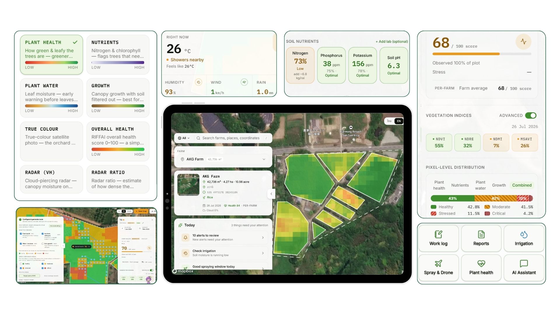
Image credit: Riffai
📊 Market size
The broader geospatial AI market represents an estimated US$101.4 billion. Defense procurement operates on high-value contracts rather than individual software licenses. Securing just ten major government customers can yield up to US$30 million in contracted revenue.
🤝 Team
- Kolatat Katousano. Founder and CEO. He draws on satellite data engineering experience from roles at Schneider Electric and The Crown Estate.
- Tinthai Bootseeta. Executive vice president of technology. He leads AI development and satellite processing.
- Puthiphat Jirawatanaphalin. Chief representative. He manages international partnerships and defense-sector engagement.
🚀 Traction
- Secured a US$3 million deployment contract with a military client.
- Generated US$150,000 from energy, disaster, and environmental monitoring projects.
- Achieved US$50,000 in revenue from agricultural farm monitoring.
- Operates in Thailand, Japan, Vietnam, Indonesia, and the United States.
🏆 Competition
The company competes with Maxar, BlackSky, Esri, and Google. Riffai distinguishes itself through a patented image metadata management system originally developed by Panasonic. The startup also trains its models on real military data rather than simulated datasets.
💰 Financials
🚩 Risks









📅 Upcoming Events
30-31 March 2027
Upskill Fest